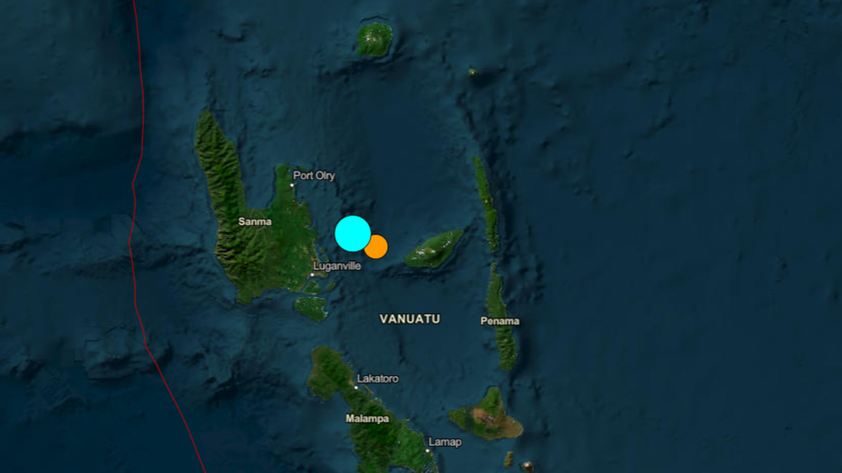
The occurrence of a magnitude 7.0 earthquake in the Vanuatu archipelago is not an isolated geological incident but a predictable output of the New Hebrides subduction zone's high-velocity convergence. While general news reporting focuses on immediate tremors, a structural analysis reveals that the Pacific Plate's subduction beneath the Indo-Australian Plate at a rate of approximately 8 to 12 centimeters per year creates one of the most active seismic laboratories on Earth. To understand the implications of this event, one must deconstruct the mechanical properties of the plate interface, the bathymetric triggers of tsunamigenesis, and the specific vulnerability of localized infrastructure within the Melanesian Volcanic Arc.
The Mechanics of Convergence and Elastic Rebound
The fundamental driver of this magnitude 7 event is the accumulation of elastic strain energy along the New Hebrides Trench. Unlike divergent boundaries where plates move apart, this convergent boundary forces the denser oceanic crust of the Indo-Australian Plate beneath the North Fiji Basin. This process is governed by the Elastic Rebound Theory, which can be quantified through the relationship between stress accumulation and frictional resistance.
$M_0 = \mu A d$
In this equation, $M_0$ represents the seismic moment, $\mu$ is the shear modulus of the crustal rocks (typically around $3 \times 10^{10} \text{ N/m}^2$), $A$ is the area of the fault that ruptured, and $d$ is the average displacement during the slip. A magnitude 7.0 event signifies a rupture area often exceeding 1,000 square kilometers with average displacements in the range of 1 to 2 meters.
The complexity of the Vanuatu region arises from the "fragmented" nature of the overriding plate. Instead of a single massive block, the region consists of several microplates, including the New Hebrides and Conway Reef plates. This fragmentation results in a high frequency of "doublet" earthquakes—where one large event triggers a second of similar magnitude nearby—due to the rapid transfer of static stress across short fault segments.
Tsunami Potential and Bathymetric Constraints
The primary risk variable following a magnitude 7 event in a maritime environment is the displacement of the water column. However, magnitude alone is a poor predictor of tsunami generation. The critical factors are focal depth and the vertical component of the seafloor displacement.
- Focal Depth Threshold: Earthquakes deeper than 70 kilometers rarely generate significant tsunamis because the overlying crust dampens the vertical energy transfer to the ocean surface. The Vanuatu event, often occurring at depths of 10 to 40 kilometers, sits within the high-risk "shallow-focus" window.
- Vertical Deformation Logic: For a magnitude 7 earthquake to generate a significant tsunami, there must be a sudden vertical change in the seafloor topography of at least 10 centimeters over an area of several hundred square kilometers. In the New Hebrides Trench, the steep dip of the subduction interface (often exceeding 45°) increases the probability of vertical seafloor motion compared to more horizontal strike-slip faults.
- Local Bathymetric Amplification: The archipelago's "V-shaped" bays and steep submarine slopes can amplify tsunami wave heights through a process of resonance and shoaling.
Infrastructure Vulnerability and Seismic Performance
The Vanuatu earthquake highlights the significant gap between modern seismic design and the reality of Pacific Island infrastructure. The "brittle-to-ductile" transition in engineering must be the focus of regional resilience strategy. Most structures in Port Vila and Santo are built using reinforced concrete frames or unreinforced masonry.
During a magnitude 7 event, these structures face a specific set of mechanical failures:
- Short-column Effect: Where rigid wall infills prevent the full length of a column from bending, concentrating shear forces and leading to explosive structural failure.
- Soil Liquefaction: Saturated, loose-grained soils—common in the coastal sediment of the Vanuatu islands—can lose their shear strength during prolonged ground shaking, essentially turning into a liquid. This undermines foundations and leads to the catastrophic tilting of otherwise sound buildings.
- Non-structural Risks: In higher-magnitude events, up to 70% of financial losses and a significant portion of injuries are caused by non-structural failures, including the collapse of storage tanks, power line disruptions, and the rupture of water mains.
The Seismicity Gradient and Regional Stress Transfer
A magnitude 7 earthquake in the Vanuatu Islands must be analyzed as a point of stress redistribution rather than an endpoint. When a segment of the New Hebrides Trench slips, it effectively "unloads" the stress at the rupture site but "reloads" the adjacent segments to the north and south.
The probability of "triggered seismicity" follows a predictable decay function. The Omori-Utsu Law describes the frequency of aftershocks, which decreases roughly in proportion to the reciprocal of time after the main shock.
$n(t) = \frac{k}{(t+c)^p}$
In this formula, $n(t)$ is the frequency of aftershocks, $t$ is the time since the main earthquake, and $k$, $c$, and $p$ are constants that vary between different geological environments. For the high-temperature, high-stress environment of the Melanesian Arc, the $p$-value—the rate of decay—is often high, indicating a rapid but intense aftershock sequence.
Systematic Data Gaps in Island Seismic Networks
The quantification of risk in Vanuatu is hindered by the density of the seismic monitoring network. While global networks like the USGS (United States Geological Survey) and the GEOFON program provide rapid estimates of magnitude and location, "near-field" data—shaking information from within 50 kilometers of the epicenter—is often sparse. This data gap creates several critical bottlenecks in disaster response:
- Inaccurate ShakeMaps: Remote sensors must rely on mathematical models to estimate the intensity of shaking at the epicenter. Without local accelerometers, these models can under-predict the localized shaking caused by site-specific geological amplification.
- Delayed Tsunami Verification: Deep-ocean tsunameters (DART buoys) are expensive and sparsely distributed. In the immediate aftermath of a magnitude 7 event, the first 15 minutes are critical for local evacuation. Without a high-density, real-time coastal gauge network, local populations are forced to rely on visual confirmation, which is often too late.
- Uncertainty in Crustal Deformation: Synthetic Aperture Radar (SAR) and GPS-based monitoring provide the only accurate way to measure how much the islands physically moved during the earthquake. This information is vital for recalibrating building codes and understanding the long-term seismic cycle.
Re-engineering the Resilience Paradigm
The strategic priority for the Vanuatu archipelago after a magnitude 7 event is the implementation of a "distributed resilience" framework. This moves away from large, centralized infrastructure that is prone to single-point failure and toward modular, redundant systems.
- Decentralized Energy: Solar-plus-storage microgrids are significantly more resilient to seismic events than centralized diesel generators and extensive overhead power line networks.
- Base-Isolation Adoption: While expensive, the introduction of base-isolation technology for critical facilities—hospitals, emergency response centers, and communication hubs—ensures that the structure can remain operational even after high-intensity shaking.
- Advanced Early Warning (EEW): Implementing a network of low-cost MEMS (Micro-Electro-Mechanical Systems) sensors across the islands to provide 5 to 15 seconds of warning before the arrival of destructive S-waves. This allows for automated actions, such as shutting down gas lines and opening elevator doors.
The magnitude 7 event in the Vanuatu Islands serves as a stark reminder that the region's geological activity is an inescapable constant. The primary challenge is not predicting the next event, but ensuring that the built environment and the monitoring infrastructure are designed to absorb, rather than break under, the inevitable release of accumulated tectonic strain.


