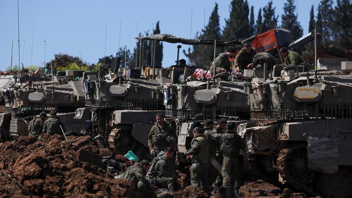
The shift from a reactive security posture to a proactive territorial seizure in southern Lebanon represents a fundamental change in the Middle Eastern geopolitical kinetic model. This is not merely a tactical maneuver but a structural realigning of the "Buffer Zone" concept, moving from a monitored electronic perimeter to a physical occupation of strategic high-grounds. The objective is the systemic degradation of Hezbollah’s short-range firing capabilities by physically removing the launch vectors from within a 5-to-10-kilometer strike radius of the Israeli border.
The Triad of Territorial Control
To analyze the current escalation, one must dissect the three operational pillars driving the Israeli military strategy:
- Topographical Dominance: Southern Lebanon is characterized by limestone ridges and deep wadis. Control over the "Blue Line" is insufficient for modern artillery defense; instead, the military seeks "Line of Sight" (LOS) dominance over the Litani River basin. By occupying the ridge lines, the Israel Defense Forces (IDF) convert a defensive disadvantage into a permanent surveillance and fire-control advantage.
- Infrastructure Denudation: The seizure of territory allows for the systematic destruction of the "Nature Reserves"—the sophisticated, subterranean tunnel networks and reinforced bunker systems Hezbollah has constructed since 2006. Stand-off munitions (airstrikes) have diminishing returns against these hardened assets; physical occupation is the only mechanism for permanent neutralisation.
- Population Displacement as a Buffer: The creation of a "no-man's land" functions as a secondary defense layer. By making the southern villages untenable for civilian return, the IDF eliminates the "human shield" variable, allowing for a "free-fire" zone where any movement is classified as hostile by automated and manned surveillance systems.
Hezbollah’s Asymmetric Friction Model
Hezbollah’s vowed resistance operates on a cost-function logic. Their strategy is not to hold territory in a conventional sense—which would be a tactical error against a superior air force—but to maximize the "Bleed Rate" of the occupying force.
The resistance model is built on Distributed Lethality. Rather than centralized command structures, Hezbollah utilizes small, autonomous cells equipped with third-generation Anti-Tank Guided Missiles (ATGMs). These units operate within a "Pre-positioned Logic," where supplies and firing positions were established years in advance.
The friction they generate is measured in three specific metrics:
- Attrition Ratio: The number of armored vehicle losses per kilometer of Israeli advance.
- Economic Strain: The cost of maintaining a mobilized reserve force versus the cost of Hezbollah’s low-tech rocket inventory.
- Political Sustainability: The threshold of casualties the Israeli public will tolerate before the domestic cost of occupation outweighs the perceived security benefit of the buffer zone.
The Geometry of the Conflict Zone
The geography of southern Lebanon dictates the limits of any occupation. The territory between the border and the Litani River is not a monolithic block; it is a series of isolated tactical pockets.
If Israel seeks a permanent seizure of parts of southern Lebanon, it faces the Occupier's Dilemma. A thin presence is vulnerable to hit-and-run ambushes, while a dense presence provides a "target-rich environment" for Hezbollah’s short-range mortars and kamikaze drones. The current Israeli strategy appears to be a "Rolling Buffer," where territory is cleared, electronic sensors are installed, and the physical troops withdraw to "strongpoints" on high ground. This minimizes exposure while maintaining fire-control.
The risk in this geometry is the "Vertical Escalation" from Hezbollah. As their terrestrial launch sites are seized, they are forced to rely on longer-range precision missiles launched from the Beqaa Valley or northern Lebanon. This shifts the conflict from a border skirmish to a national infrastructure war, widening the target set to include power grids, ports, and dense urban centers on both sides.
Data-Driven Constraints on Occupation
Historical precedent from the 1982–2000 occupation suggests that the maintenance of a "Security Zone" requires a specific ratio of troops to territory to prevent infiltration. Current modern warfare adds the variable of Unmanned Aerial Systems (UAS).
The cost-benefit analysis for Israel hinges on the Interception Math. If the Iron Dome and David’s Sling systems maintain a high interception rate, the pressure to occupy deeper into Lebanon remains manageable. However, if Hezbollah saturates these defenses with "swarms," the IDF is compelled to push further north to find the launch origin points. This creates an "Expansion Loop" where each kilometer gained increases the perimeter that must be defended, requiring more manpower and increasing the probability of casualties.
The "Parts to be Seized" mentioned in recent reports likely correspond to the Salients—the specific geographic protrusions into Israel that provide Hezbollah with the best lateral firing angles. Seizing these specific nodes is a surgical territorial strategy aimed at breaking the "Enfilade Fire" capability of the resistance.
The Technological Evolution of the Border
The occupation of 2026 is not the occupation of 1982. The IDF is deploying a "Sensor-to-Shooter" network that utilizes AI-driven target identification. This system maps the terrain in 3D, identifying changes in the landscape (e.g., a newly moved rock or a shifted bush) that indicate the presence of an IED or a hidden launcher.
Hezbollah’s counter-technology involves Electronic Signature Minimization. They have reverted to wired communications to bypass Israeli SIGINT (Signals Intelligence) and use thermal-masking materials to hide from overhead drones. This is a "Low-Tech vs. High-Tech" stalemate where the advantage fluctuates based on environmental conditions and the specific "Engagement Window."
Strategic Forecast and Operational Logic
The current trajectory indicates that Israel will establish a "De Facto Annexation" of the immediate border ridgeline. This will not be declared as a permanent border change but will be maintained as a "temporary military necessity" indefinitely.
For Hezbollah, the strategy will shift from "Border Defense" to "Strategic Depth Harassment." They will likely concede the immediate 5-kilometer strip to preserve their primary fighting force for a war of attrition. The conflict will then settle into a Static Kinetic Equilibrium: Israel holds the high ground, while Hezbollah maintains a persistent, low-intensity strike capability that prevents the return of Israeli civilians to northern Galilee.
The pivot point for this conflict lies in the Litani Threshold. Should Israeli forces cross the Litani River in force, the conflict ceases to be a buffer-zone operation and becomes a total war. Until that threshold is crossed, both sides are engaged in a "Positional War" where geography is the currency of security. The seizure of southern Lebanese territory is an attempt to buy security with land, a transaction that historically carries a high interest rate in the form of perpetual insurgent friction.
The strategic play is the deployment of permanent automated turret systems and localized "Micro-Fortresses" along the seized ridges. This replaces high-casualty patrols with high-cost technology, shifting the burden from human capital to the Israeli defense budget. Hezbollah's response will be the deployment of "Loitering Munitions" designed to target the optics of these automated systems, initiating a cycle of "Silicon Attrition" where the side that can out-manufacture the other's sensors or drones gains the upper hand.