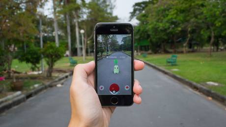
Niantic’s deployment of Pokémon GO transcends gaming to function as a planetary-scale data ingestion engine, converting millions of decentralized human movements into a high-fidelity, machine-readable map. This process, which the company labels "Visual Positioning System" (VPS), represents a transition from static satellite imagery to dynamic, ground-level environmental reconstruction. The economic value lies not in the microtransactions of a mobile game, but in the creation of a proprietary, sub-meter-accurate 3D model of the physical world—a digital twin optimized for autonomous systems and spatial computing.
The Tri-Layer Logic of Geospatial Data Acquisition
The architecture of Niantic’s data collection relies on three distinct layers of interaction that turn casual play into labor. To understand the scale, one must look at the transition from Google Maps’ top-down orthophoto approach to a bottom-up, crowd-sourced photogrammetry model.
- The Incentive Layer: Players are motivated by digital scarcity (rare Pokémon) and territorial control (Gyms). These markers are not randomly placed; they are strategically anchored to "Wayspots"—physical landmarks that Niantic requires users to verify and scan.
- The Capture Layer: Through "AR Mapping" tasks, users provide multi-angle video frames of physical objects. This is essentially decentralized SLAM (Simultaneous Localization and Mapping). While a single drone or satellite sees a roof, ten thousand players see the texture of the brick, the height of the curb, and the specific orientation of the entrance.
- The Processing Layer: Niantic’s Lightship platform ingests these frames to build a "point cloud." This is a sparse 3D representation where distinct features (corners, edges, color gradients) are assigned coordinates.
The Cost Function of Global Mapping
Traditional mapping entities (Google, TomTom, HERE) face a massive "refresh rate" bottleneck. Physical environments are entropic; stores close, facades change, and construction alters geometry. Maintaining a "live" map via professional fleets is economically unsustainable at the centimeter scale.
Niantic solved this cost function by externalizing the operational expenditure of data collection to the consumer. The user pays for the hardware (smartphone), the connectivity (data plan), and the energy (battery), while providing the labor (scanning). The "cost per square meter" for Niantic trends toward zero as user density increases, creating a competitive moat that legacy mapping companies cannot bridge without similar gamified crowdsourcing.
Structural Bottlenecks in Spatial Intelligence
Despite the volume of data, the transition from "video of a park bench" to "semantic understanding of a city" faces significant technical friction.
The Fidelity-Latency Tradeoff
High-fidelity 3D maps require immense storage and bandwidth. For an AR device to "localize" itself instantly, it cannot download a city’s worth of data. Niantic utilizes a "Map Partitioning" strategy, where the world is divided into discrete cells. When a user’s GPS coordinates enter a cell, the device downloads only the local point cloud "fingerprint." The system then compares the live camera feed to this fingerprint to determine the user's position within centimeters.
The Semantic Gap
A point cloud is mathematically precise but semantically blind. A computer sees a cluster of points; it does not inherently know it is a "fire hydrant" or a "private driveway." Niantic employs Large Model training—specifically multimodal models—to auto-label these point clouds. This transforms a geometric map into a semantic map, which is the prerequisite for autonomous delivery robots and smart city infrastructure.
The Privacy Paradox and the Erosion of the "Right to Obscurity"
The competitor’s narrative often ignores the shift from data privacy to "spatial privacy." While standard GPS tracking identifies where you are, Niantic’s VPS identifies what you are looking at and the interior geometry of spaces that satellites cannot reach.
The mechanism of "Wayfarer" (the player-driven review system) serves as a decentralized regulatory body. Users nominate and vote on what parts of the world are "noteworthy." This creates a filtered reality where areas with low player density or lower socioeconomic status remain "dark" on the digital twin, leading to a new form of digital redlining. Furthermore, the persistent scanning of public-facing private property (front doors, gates, business interiors) bypasses traditional "Street View" privacy protections because the data is collected by individuals rather than a corporate vehicle.
The Strategic Shift to the AR Cloud Market
Niantic is not competing with Electronic Arts; it is competing with NVIDIA and Apple. The end-state of this technology is the "AR Cloud"—a persistent, shared digital layer over the physical world.
The value of the AR Cloud is derived from two primary functions:
- Persistence: If one user leaves a digital note on a physical wall, another user should see it there three weeks later. This requires a sub-centimeter understanding of the wall's geometry.
- Occlusion: Digital objects must be able to go "behind" physical objects. For a digital Pikachu to hide behind a real tree, the system must know the tree's volume and distance relative to the camera.
By owning the map that enables persistence and occlusion, Niantic positions itself as the "Spatial Internet Service Provider." Any hardware manufacturer—whether it’s Meta with Ray-Ban glasses or Apple with Vision Pro—that wants their device to function seamlessly outdoors will eventually need to license a map that is updated in real-time.
The Competitive Moat: Network Effects of Human Motion
The difficulty in replicating Niantic's model is not the software; it is the "Human Motion Network Effect."
- Data Density: More players lead to more scans.
- Map Accuracy: More scans lead to better localization.
- User Experience: Better localization leads to more players.
A competitor entering the space today would need to incentivize millions of people to walk specific paths and record video for no immediate financial gain. The "gamification" of the labor is the only known mechanism to achieve this at scale.
The Implication for Autonomous Systems
While the immediate application is entertainment, the underlying dataset is a training ground for edge-case navigation. Autonomous vehicles currently struggle with "the last fifty feet"—navigating from the curb to the doorstep. Niantic’s data includes exactly this: the pedestrian-level pathways, the placement of doorbells, and the height of porch steps.
This dataset represents a bridge between high-speed road navigation (Waymo/Tesla) and granular human-centric navigation. The strategic pivot for Niantic will likely involve the commoditization of this "pedestrian-level" data for logistics and robotics firms.
The most viable strategic play for an entity looking to challenge this dominance is not to build a better game, but to create an open-source protocol for "Spatial Mapping Incentives." If users could own the tokens generated by their spatial data—essentially "Proof of Mapping"—the centralized advantage held by Niantic’s proprietary database would be threatened. Until a decentralized alternative emerges, the physical world is being systematically indexed into a private, monetizable graph.
Focus development efforts on integrating the Lightship VPS into non-gaming applications, specifically targeting localized retail and "smart" navigation, as the true equity of the firm lies in the precision of the coordinate system rather than the longevity of the intellectual property.